Tunnel & Bridge
Inspections
Infrastructure Needs Eyes Everywhere
Bridges and tunnels are critical arteries of urban and industrial infrastructure. They demand precise, regular inspections to ensure structural integrity, public safety, and operational continuity. At 33Visual, we combine drone-based data capture, LiDAR SLAM, and immersive visuals to deliver actionable insights where traditional methods fall short.
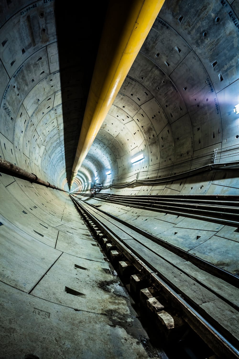
Tunnel Inspections: Precision Without GPS
Active tunnels pose unique challenges: GPS-denied environments, limited access, and continuous vehicle traffic. For these scenarios, we deploy:
LiDAR SLAM Systems – Vehicle-mounted LiDAR with Simultaneous Localization and Mapping (SLAM) creates highly accurate point clouds without relying on GPS. Ideal for tracking deformation, crack evolution, and water ingress.
360º Imaging – Used for documentation, safety audits, and stakeholder communication, our high-resolution 360° cameras provide a clear visual record of interior conditions.
This workflow allows asset managers and engineering teams to conduct remote inspections, monitor changes over time, and plan interventions—safely and efficiently.
Bridge Inspections: Eyes Where Others Can’t Go
For bridges, our drone infrastructure brings access, autonomy, and accuracy. We use pre-programmed autonomous flight missions to replicate paths over time—ideal for progress tracking, comparison studies, and large-scale inspection plans. Capabilities include:
Close-Proximity Visual Inspection – Drones fly around piers, girders, and expansion joints to detect cracks, rust, and wear.
Thermal Imaging – Thermal sensors identify water infiltration, insulation loss, or stress concentrations.
3D Modeling and Photogrammetry – We deliver models scaled for CAD/BIM use, enabling design validation or digital twin creation.
These drone missions reduce inspection time, eliminate the need for scaffolding or lane closures, and enhance safety for all teams involved.
Smart Deliverables, Built for Action
We don’t just inspect—we deliver insight. Each mission results in a customized digital package:
LiDAR point clouds and elevation profiles
Thermal maps with annotated faults
360° immersive walkthroughs for stakeholder review
Photogrammetric models for engineering integration
Time-lapse visual comparisons over multiple visits
Everything is platform-ready and secure—designed to work within your preferred inspection or asset management ecosystem.

Certified, Scalable, and Field-Proven
33Visual operates under strict safety and compliance protocols. Our teams are certified for confined spaces, working at height, and GPS-denied environments. We are fully insured, drone-licensed, and maintain a 20+ year zero-incident record.
Let’s Inspect Smarter. From metro tunnels to coastal bridges, we deploy the right tools for each infrastructure challenge—supported by autonomous flight plans, sensor-rich data capture, and a focus on client outcomes. We’re passport-ready and operational in North America, Latin America, the UK, and Europe.
Contact us

Add your email to access
We HATE spam. Your email address is 100% secure.